How to Get Out of Hanoi By Bike
Going on a motorbike tour? Leaving from Hanoi? Well, you’re going to need to know how to get out of Hanoi first. This post offers some suggestions on how to get out quickly and get to the places that you want to spend time. There are more scenic and quieter routes but these will mean you can’t get as far as you might need to on the first day.
Pretty much most of the time, your first day is not going to be a great one. You will need to get out of the city and away from the traffic. This means you will need to drive on big roads in order to get the distance you need away from the city. Hopefully, you have 3+ days and this means that the majority of your trip can be on more scenic roads.
A Few Tips Before We Start
Set your Google Maps to ‘avoid tolls’, and ‘avoid highways’. If you have it use the motorbike route function. This will stop Google routing you on the larger CT roads that you are not allowed to use.
Be very careful in built-up areas. When you are shadowing cars you need to be aware that the speed limits are different for cars and motorbikes. In town, cars can travel at 50kmh, whereas, motorbikes are only allowed to travel at 40kmh. Cops know this and love to point it out to you.
Map of Routes Out of Hanoi
This map shows you the routes that I have outlined below as well as some easy to find petrol stations and a few interesting places to stop. If you would like a KMZ file of any of the routes or more help on a specific route, just email us and we’ll be happy to help you out with a few extra tips.
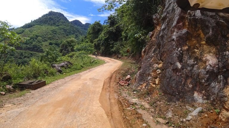
Route 1 – To Mai Chau / Hoa Binh
This a classic and very well worn route. It passes through some nice countryside and there are many variations on this. Actually, we love the area so much it features on a good few of our motorcycle tours, including the 2 day Northern Shore loop and the 6 day Reservation Hop tour.
Waypoints (to type into Google)
Van Cao / Quoc Oai / Either Hoa Lac or Xuan Mai
Why would you take this route?
Is it an easy route?
It is quite easy to follow the road around the lake even though it is a little slower than the bigger roads. You then head down Van Cao and you can go straight for at least 20km. The roads are fairly big and easy to negotiate. Obviously, at peak times it is not so easy. Therefore, don’t leave at peak times: 7 am to 9 am.
What is the first realistic stop on this route?
Where to get petrol?
If you haven’t filled up already, you would probably make it to the CT 08 and be able to fill up there. There are plenty of filling stations on the CT08 route. If you are unsure about how petrol works in Vietnam, you can have a look here.
What CT roads to avoid?
You need to avoid the CT 08 but this is very easy to do. You will pass Big C on the right and then go under an underpass. It is a short way after this that you will see all (well, most) of the two-wheeled traffic bear off to the side road on the right. This Is the correct road for you.
Interesting sites on the route
This route has a lot of interesting places along the way. These include Chua Thay Pagoda, Hoa Binh Dam, Deo Da Trang (Thung Khe Pass) and Mai Chau Flag Post. There are also more places of interest, but these involve taking a slightly different route. It is possible to stop at these, for a short while, and still have time to get to Mai Chau, if you leave nice and early. However, you may not have the energy to do all of this. Choose wisely.
Route 2 – To Ninh Binh / Cuc Phuong
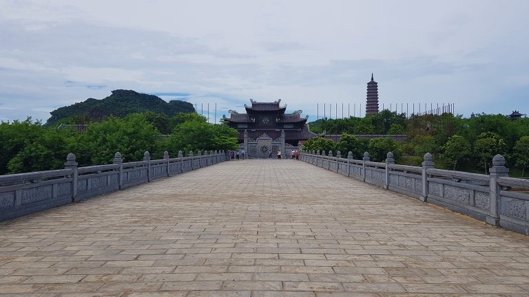
There are 3 main variations on this route and the one given here is my preferred route. There is not much to see on the way but this route offers a welcome alternative to the highway.
Waypoints (to type into Google)
Cau Chuong Duong / Ecopark / Hung Yen / Phu Ly / Ninh Binh
Why would you take this route?
If you are going to Ninh Binh, Trang An, Tam Coc, Cuc Phuong or Van Long then this would be a good route to take. All of these places should take between 3 to 4 hrs to reach.
You could, of course, take the QL1A, but this is the main road for buses and trucks that do not want to pay the tolls for the CT roads. It will be busy and stressful. You will also have to find your way across town to get there. By crossing either Long Bien or Chuong Duong Bridge you are getting to the quieter roads much more quickly.
Is it an easy route?
Generally speaking, yes, it is an easy route. It is a little difficult at first as you have to get to one of the bridges. This means a little city driving. However, once you get on to the ‘Dyke’ road (DT378), you will find the road is quiet and not so stressful. You will need to keep an eye on your map as it can be easy to stray off the blue line.
What is the first realistic stop on this route?
Hung Yen is the first place that you can rely on to have lunch. There are lots of roadside vendors between Hanoi and Hung Yen but you cannot be sure that they will be open or what they will have.
In terms of overnight, you are really looking at Ninh Binh as being the first potential place to stay. Both Hung Yen and Phu Ly are not far enough away to warrant staying overnight nor have enough to interest you.
Where to get petrol?
When you come off the Chuong Duong Bridge and then along the DT378 for a short way you can get petrol. However, you need to drive slowly and keep your eyes open as this petrol station is on the other side of the dyke. The dyke is about 2m high and solid concrete. There are gaps in this to let vehicles in and out. You will need to go through one of these gaps to get to the petrol station. It isn’t hard but you need to keep your eyes open. If you are unsure about how petrol works in Vietnam, you can have a look here.
What CT roads to avoid?
On the first half of this route, it would be very hard to go onto a CT road. However, on the second half, after Hung Yen and closer to Phu Ly, you need to be careful not to accidentally end up on the CT 01
Interesting sites on the route
Unfortunately, there is very little that is noteworthy on this route other than the everyday sights of life in Vietnam.
Route 3 – To Hai Phong / Cat Ba
A shocking route. Consider taking your bike on the train or just take the train and come back to do a different tour. There is nothing but industrial complexes all the way along this busy highway. However, Cat Ba is great, when it isn’t the holiday season.

Waypoints (to type into Google)
Chuong Duong Bridge / Cay Xang Chuong Duong / Hai Duong
Why would you take this route?
The main reason to go on this route would be to get to Cat Ba Island. You can take the first part and then turn off to Lang Son (more on that below). You might also want to go this way to get to Ha Long city.
Is it an easy route?
It is pretty easy to follow but it is quite a dull ride and it is also a busy road. It is quite dangerous and you may be better placed to put your bike on the train. Yes, it is possible.
What is the first realistic stop on this route?
Once you are over the bridge and on the AH14, there will be quite a lot of places to stop. This is a very busy road and as such has stops all along it for water and food. The first main town is Hai Duong and you could stay there but there is not much there and it is not too far away. If you leave late and only make it to Hai Phong there are plenty of places to stay in this town and it is quite nice in the centre. Bear in mind that the ferry to Cat Ba will close at around 5.30pm. This route is not like the route through Ha Long where the ferry operates 24hrs.
Where to get petrol?
Again, as you turn on to the AH14, you will see a huge petrol station on the right-hand side. This is an easy place to fill up. There are plenty of filling stations on the AH14 as it is a huge road that takes a lot of freight to the port of Hai Phong. There is little fear of being stuck without fuel. If you are unsure about how petrol works in Vietnam, you can have a look here.
What CT roads to avoid?
There is a section of road called the QL5B and this is for cars. It is a CT road and it has tolls on it which you cannot pass on a motorbike. It runs kind of parallel to AH14 and it is quite easy to get mixed up and routed on to this road.
Interesting sites on the route
This route has very little of note that is close by. The road winds through several industrial towns and is the main freight route. The jewel is at the end of the journey.
Route 4 – To Lang Son
This is another one of those ‘pretty dull’ routes. Get it over and done with and then you will be in ‘Karst Country’ and things will seem worth it.
Waypoints (to type into Google)
Chuong Duong Bridge / Big C Long Bien / Tu Son / Bac Ninh / Bac Giang
Why would you take this route?
This route will get you up to Lang Son, really quickly. If you leave early enough you will have time to go further on if you wish. You could make it to Cao Bang in the East if you really wanted to but that is a BIG ride.
I would suggest heading in this direction and then staying somewhere like Bac Son for the night. This will get you off the main road and you can stay in a quieter village and not a town. There is not too much of interest in Lang Son and the road there is busy as it is the main route to the border with China. A lot of freight takes this route.
Is it an easy route?
Yes, it is easy enough, but Google will try to route you on a more direct route. This route is ok if you want to travel on the smaller roads. I have marked the larger road so that you can see how to get to Lang Son quickly. There is little to see on the way, so getting up to the turn off for Huu Lung is, in my honest opinion, the best thing to do. Then you can take it easy.
Note: VietClimb runs a homestay and climbing wall in Huu Lung and it is well worth a visit.
This route is a big fast road and the hard part is getting over Chuong Duong Bridge and out of Hanoi. Once this is over, you just need to ride sensibly and watch out for trucks.
What is the first realistic stop on this route?
This is a tough one because as soon as you get on to the QL1A you will be on a highway straight up to Lang Son. If you want to stop for more than a drink and pit stop, you will either need to take a detour into Bac Ninh or Bac Giang. This will cost you a fair amount of time. There are plenty of service stations on this route and you will find large ones that have restaurants as well as drink stalls. Again, do what you need to do or get what you need to get before the turn off the 243 if you are going that way.
Where to get petrol?
You can get petrol at the same spot as Route 3 because it is on the way. Also, there is plenty of fuel on the main route up to Lang Son. If you turn off onto the DT243 heading for Huu Lung and Bac Son (quinh Mai), then it would be good to fill up before leaving the main road. AND bear in mind that the turning for the 243 is quite hard to see. Go slowly to see it. If you are unsure about how petrol works in Vietnam, you can have a look here.
What CT roads to avoid?
There are not any CT roads to avoid on this route and it is hardly likely that you will get anywhere near one. Fingers crossed 😊
Interesting sites on the route
This is another route that winds its way through industrial towns. However, there is a little more history here. You may notice Kep Air Strip as you go through and stopping at the monument to the battle Chi Lang is a good idea. If you turn off to Bac Son you will go past the VietClimb Rock Wall.
Route 5 - To Thai Nguyen
Waypoints (to type into Google)
Nhat Tan Bridge / Noi Bay Airport / Soc Son / Ba Hang / Thai Nguyen
Why would you take this route?
This route will get you to Thai Nguyen in about 2hrs. It is a good start on the way to Ba Be Lake (240km) or Bac Kan (160km).
Note: If you are going to Ba Be Lake, it is generally better to head up to Phu Thong or Na Phac and then turn West as there are currently major roadworks on the DT254. This is about 35km of mud and hassle. You need the right bike and the right mindset to go this way. You could even try to get up to Cao Bang but that is quite a drive (275km, 6 hrs) and wouldn’t be too much fun. You would have to leave early to do that too.
Is it an easy route?
Yes, it is the main road all the way. You do need to pay attention to the signage as you also have to turn off this road just after Nhat Tan bridge and drive on the side road. It isn’t listed as a CT road but no bikes are allowed.
There is also the tricky section near the airport that may cause some grief. This is where you turn off the AH14 and onto the QL2A heading to the QL3. You need to drive slowly and not miss this turn. It is a T junction and you turn right but still, watch out for it. Once that is over you head straight and stop when you need to stop.
What is the first realistic stop on this route?
Stopping at somewhere like soc Son is a good idea as this is when you tend to just head straight. You will be out of the city and the niggly driving and there will be plenty of small places to stop for drinks. Thai Nguyen isn’t so far that you will get hungry on the way and there is a huge selection of places to eat in the town itself.
Where to get petrol?
Filling up before Nhat Tan Bridge at Lac Long Quan St is a good idea. You will have more than enough fuel to get to Thai Nguyen. If you are unsure about how petrol works in Vietnam, you can have a look here.
What CT roads to avoid?
You need to avoid the CT07 on this route. It is quite easy to do so.
Interesting sites on the route
There is not much to see on this route unless you count the golf course or the Samsung Factory as sights worth seeing. Just keep driving.
Route 6 – To Tuyen Quang
Ok, so the first part of the route is dull. However, once you get to the Vinh Phuc area near Tam Dao You will start to really enjoy the driving. This won’t take long and it will be worth it.
Waypoints (to type into Google)
Nhat Tan / Noi Bay (after this it is hard to give notable waypoints)
Why would you take this route?
This is a good route for those that are heading for either Sa Pa (in two days, 380km, and stopping in Thac Ba, 160km) or Ha Giang, 300km (either one day or two).
Is it an easy route?
The first half-section is quite easy as it is the main road. The difficulty is staying away from the CT road. However, the section just before Noi Bai Airport is quite difficult and you need to pay very close attention to the underpasses. Most times you will end up being forced to drive the wrong way down the highway and the cops know this and are often waiting. The traffic on this is quite heavy too but for this first section you will be on the side road with the motorbikes, so it won’t affect you too much.
The second section is difficult to follow as it is quite a small road and there are lots of twists and turns that Google seems to get confused with. However, the traffic is much lighter and the scenery much more enjoyable.
What is the first realistic stop on this route?
Getting to the airport is quite fast and your first stop for a drink and relax shouldn’t be until after this. QL2A is a good place to stop for a drink and collect everyone before you try to get onto the QL2C. All along the 2C, you will find small places to eat. Nothing special. It won’t be until you get to Tuyen Quang that you will find larger restaurants and more variety. Tuyen Quang is fairly small with little to see but it does make a very efficient halfway stop on the way to Ha Giang.
Where to get petrol?
The petrol station in Lac Long Quan is a good place to fill up. If you don’t, you can wait until you are past the airport and there are lots of stations on the QL2A. If you are unsure about how petrol works in Vietnam, you can have a look here.
What CT roads to avoid?
The CT05 is a real tricky monster and it is quite hard to stay off it. I think this is because Google has hard work with all the small roads that surround it. Keep your wits about you, and your Google Maps correctly set, so that you can avoid going round in circles.
Interesting sites on the route
On this route, the main attraction is the mountain range that runs alongside you. Of course, you will pass Noi Bai Airport (interesting for some, maybe) and you may be able to see the peaks of Tam Dao and Tam Dao Nord.
Route 7 - Yen Bai
This route is not that much fun until after Son Tay. This is when things start to get calmer and more interesting. Then following the river becomes quite pleasant.
Waypoints (to type into Google)
Thang Long Bridge / Phung / Son Tay
Why would you take this route?
This is another route that will have you going halfway to Sa Pa. You can choose to stop here, or better still Thac Ba Lake, to break up the long drive to Sa Pa or Ha Giang. If you can’t quite make it to Nghia Lo for some reason, then this makes a good stop and you can continue on the Nghia Lo route the next day.
Is it an easy route?
YES. It is a really easy route. The only difficulty is a small part around Duong Lien Mac where you need to get across to the QL32. Heading up the river and under the two bridges is much better than fighting the traffic across town to the QL32. When you get to the 32 on this route is has become a much easier road to follow in terms of traffic.
Then, after Phu Tho, you will find the road might be a little hard to follow as it is less used nowadays. It shouldn’t, however, pose too many problems as long as you keep aware.
What is the first realistic stop on this route?
Son Tay is a good place to get to as it is quite big and you will know you are there on the run into town. There are lots of cafes and restaurants as it is a big place. It isn’t anywhere you would want or need to stay. Phu Tho would be that (at a push) and Yen Bai would make more sense even though it also isn’t a great place to stay.
Where to get petrol?
Filling up at Lac Long Quan is a good idea. There a lot of fuel stations on the route. If you have enough fuel, then why not get to Son Tay and then stop for drinks or food. Often people will leave early and then have breakfast here. You can all meet up on the run into town and then find a place. Here are a few notes about getting petrol.
What CT roads to avoid?
Once you get past Phu Tho you will need to avoid the CT 05. You can do this by following the road along the river. It is quite nice but slower and longer.
Interesting sites on the route
Son Tay is on this route and you could visit the Citadel quickly. There are lots of cafes and stalls here. It is a good place to have breakfast or lunch. You will pass near Phu Tho and although it is a nice little town, it isn’t worth stopping really.
If you take a detour you can get to Hung Temple which is a huge complex of temples. It will probably take too long to visit and make to destination in time. Yen Bai itself is nondescript and it is better if you have time (1hr min) to head over to Thac Ba to stay.
Route 8 – To Nghia Lo
Waypoints (to type into Google)
Big C (Thang Long) / Hoa Lac / Ba Vi / Xuan Son
Why would you take this route?
This route will take you on what I call ‘The Middle Road’. This will get you up to Sa Pa in a minimum of 3 or so days. There are plenty of stops and the route is well worn, so homestays are easy to find.
This might seem like a longer route than taking the QL32, like Route 7 above, but the road out of town is good and fast. You take the CT08, the side road, and you can be in Hoa Lac in about 1hr.
Is it an easy route?
Yes. The hard part is getting out of Hanoi and I suggest going around West Lake and then heading straight to Hoa Lac. It is about 35km and it is a straight road. It is a little congested in the beginning but this is a wide road and not too difficult to negotiate. Once you are past Big C things get much quieter and easier.
After Hoa Lac, it is just a matter of following the blue line and this isn’t too difficult. The road is good tarmac. You will need to follow closely when skirting around Ba Vi and once you are over the river looking for QL70B. However, after that, it is very straight forward.
What is the first realistic stop on this route?
It could be a good idea to stop around Big C or a little after once you are on the side road. This is to make sure you are all together. If you need fuel you will probably stop here anyway.
Then the next logical place to stop would be Hoa Lac. This should be about an hour out and it will be time for a drink and to regroup. There are plenty of places to stay in the Ba Vi area. My favorite is Uncle Ty’s Farmstay if you are doing an overnight trip. Assuming you are taking a longer trip, I would stop somewhere around Son Tay and then further on in Thu Cuc near Xuan Son National Park.
After Thu Cuc the road is great and you will go through the tea fields and there are lots of cool little places to stop. Nghia Lo is a reasonably sized town and has a wide range of accommodation. I really like VEV Phuot Homestay.
Where to get petrol?
You can fill up on Lac Long Quan near the shop or on the CT08. After that, you will probably have enough fuel to get to Nghia Lo. There are plenty of fuel stations en-route. There is some info about getting petrol here.
What CT roads to avoid?
This is another case of avoiding the CT 08, which is not difficult at all. As you exit the underpass, look out for the HUGE turn off to the side road and follow all the other bikes that are turning off. Easy.
Interesting sites on the route
Along the way here, you will pass Ba Vi mountain and hopefully, you will see the peaks. There is also a nice little stop at the Tea Fields and you will pass, but not really see, Xuan Son National Park.
Things Change: Let us know!
These routes are guidelines, nothing more. Of course, there are other ways to get to the same places. If you have a destination in mind, let us know and we can give you full details of why we have chosen these specific roads.
Each trip and each group of riders are different so with more detail about your plans we can advise you more precisely. These ‘cookie-cutter’ routes might not be right for you. Get in touch.
Also, bear in mind that things change. If you take one of these routes and find something has in fact changed, contact us so that we can update this blog for the benefit of everyone.
