Lung Cu Flag Tower - The top of Vietnam
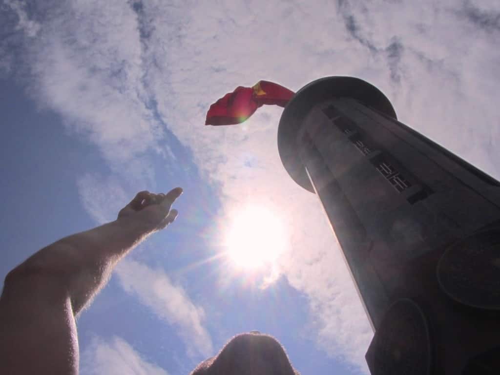
The northernmost point of Vietnam is in Dong Van Province, Ha Giang and is marked by Lung Cu Flag Tower. The tower is about 20km from Dong Van and 170km from Ha Giang. It actually sits 3.3km from the border but that isn’t really important, right? It symbolizes the strength and, the persistence of the Vietnamese to repel invaders. That’s the important bit
While the flag tower features on a number of our motorcycle tours, including the 8 Day Ha Giang Loop and the massive 11 day Northern Hold Out, you can visit pretty easily yourself! To get to the Lung Cu, you need to turn off the QL4C and take the road through Ma Le Village. If you are lucky you will get to see the local market that takes place here on Saturday mornings.
The road is worse than the 4C for the most part. There are stunning views so keep your eyes on the road and watch out for blind corners and crazy drivers. You will see your fair share of these.
Google Map
The Foundation
The flagpole is built on a small mountain called Rong (dragon) Mountain. First you need to climb the steps to top of this mountain and to the base of the Flag Tower. That is over 200steps. I lost count. You are then at somewhere between 1600and 1700m above sea level, which is quite high for Vietnam.
This is where you buy your ticket (20,000vnd) and can also get a souvenir or drink, if you wish. You then have to scale the Flag Tower itself
Note: If you are nervous in high places, this is the place to stop. Don’t worry though, as the view is already spectacular.
The Viewpoint

From the top, which is another 140 steps (33m) inside the 3.8m wide tower, it is possible to see out across the border to China. You can also see two semi-circle lakes that are said to be the eyes of the dragon (dragon Mountain, remember?) You will then be next to the flagpole which holds the Vietnamese flag. This one is 54m2; representing the 54 ethnic groups living in Vietnam.
Photo Tip: Most tourists have lunch at midday and avoid the heat, too. If you want to have the place to yourself, and can brave the heat, be at the top at this time. You will then get all the selfies and panorama shots that you want.
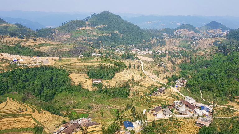
From the top you can see back to Dong Van and Ma Le as well as out to China. Below you will be villages of H’Mong, Lo Lo, Tay and Pu Peo people. This are is affectionately knows as Corn Valley due to corm being the staple crop.
Update: Since this visit, there has been a controversial building built near the tower and this may spoil the view

History
In the ancient historical records there is information about Lung Cu Flag Pole going back to the 10th century. At that time, it was built from 10m tall China Fir trees by the Ly dynasty. Then, in 1887, it was rebuilt and expanded. It has been rebuilt several times since.
Around the Flag Tower
There is a small village with market that surrounds the tower and further out amongst the corn fields you will find the northernmost cafe (Cafe Cuc Bac) and one or two homestays run by the local Lo Lo ethnic people. You can stay overnight.
Other than that it is just fields, hills, the Nho Que River and the border with China. Be careful not to wander too far!

Should you Visit?
It is not far from Dong Van. It’s a great drive. You can stop off at Ma Le Market. You can explore the area below and go to Cafe Cuc Bac (the northernmost cafe) or stay in the Lo Lo guesthouse. What’s not to like?
Yes, you should visit and maybe even spend the night there rather than in Dong Van.


